Urban Planning

Drone data creates accurate 2D and 3D models that integrate seamlessly with local geographic information systems, helping teams visualize results

Professional Services for Urban Planning


Drone data creates accurate 2D and 3D models that integrate seamlessly with local geographic information systems, helping teams visualize results. Design and plan more effectively with 3D reality models that accurately reflect landform and architectural information. Obtain accurate 2D maps and 3D models of the landscape as frequently as required to ensure proper, up-to-date classification. o Quickly map corridors such as rivers, bridges, and roads, creating accurate 2D and 3D models to facilitate maintenance and inspection.

Urban Planning Solutions

City Modeling

Create 3D models with accurate, geo-referenced data that can be readily fitted into the BIM models to visualize designs. Plan more effectively with 3D reality models that accurately reflect landform and architectural information. The 3D models generated using photogrammetry software are compatible with a variety of GIS software, streamlining the planning process.

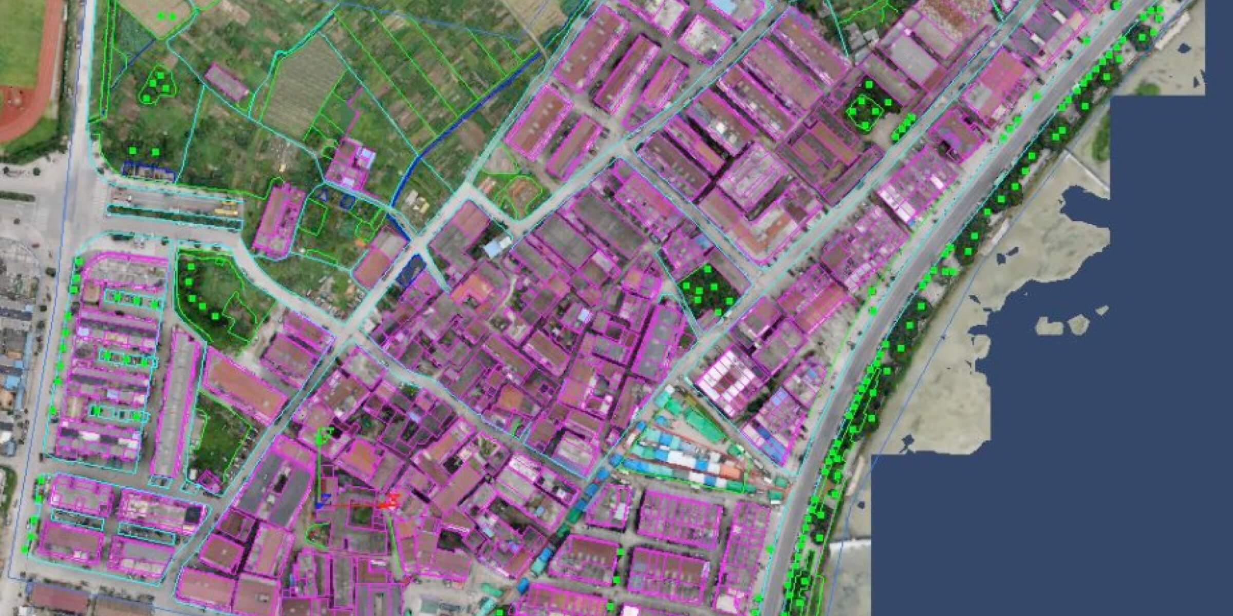
Urban-Rural Classification

Surveying drones and software solutions combine multiple types of geographic information to create 2D orthomosaics and 3D models to help with classification and planning. The 2D maps and 3D models generated are compatible with a variety of GIS software, so results can be quickly visualized for timely adjustments. Aerial data collected by drones can be used to create topographic maps for additional feature analyses.
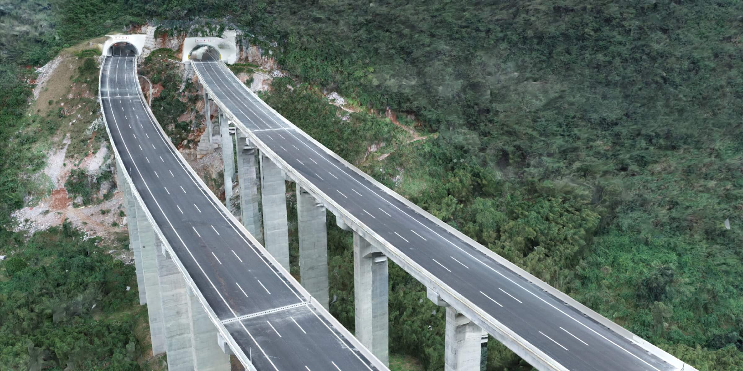
Corridor Mapping

Surveying drones and software solutions combine multiple types of geographic information to create 2D orthomosaics and 3D models to help with classification and planning. Drones can be operated in complex terrains, with intelligent features that follow the terrain to ensure flight safety without compromising data accuracy. The 2D maps and 3D models generated are compatible with a variety of GIS software, so results can be quickly visualized for timely adjustments.

Why Pisano Industries

Pisano Industries has been trusted by hundreds of worksites across the country to provide mission critical data. We are focused on safety, standard of quality, and hassle-free operations with great customer service. Our vetted and trained pilots are available nationwide, insured, and compliant with regulations. As the world’s trusted Aerial Data Acquisition Service Provider, we will deliver ROI-positive results that are more cost-efficient than building an in-house drone program.

// Drop us a line! We are here to answer your questions 24/7

NEED A CONSULTATION?