
Parking Lot Inspections
Drones can obtain imagery on pavement conditions so you can find stress cracks and wear faster than ever.
Roof & Equipment Inspections
Safely inspect hard to access areas with standard or thermal imagery to evaluate roof conditions, water damage, and more.

Marketing Material
Illustrate proximity to nearby roads and other features with a bird’s-eye view and angles only a drone can capture.
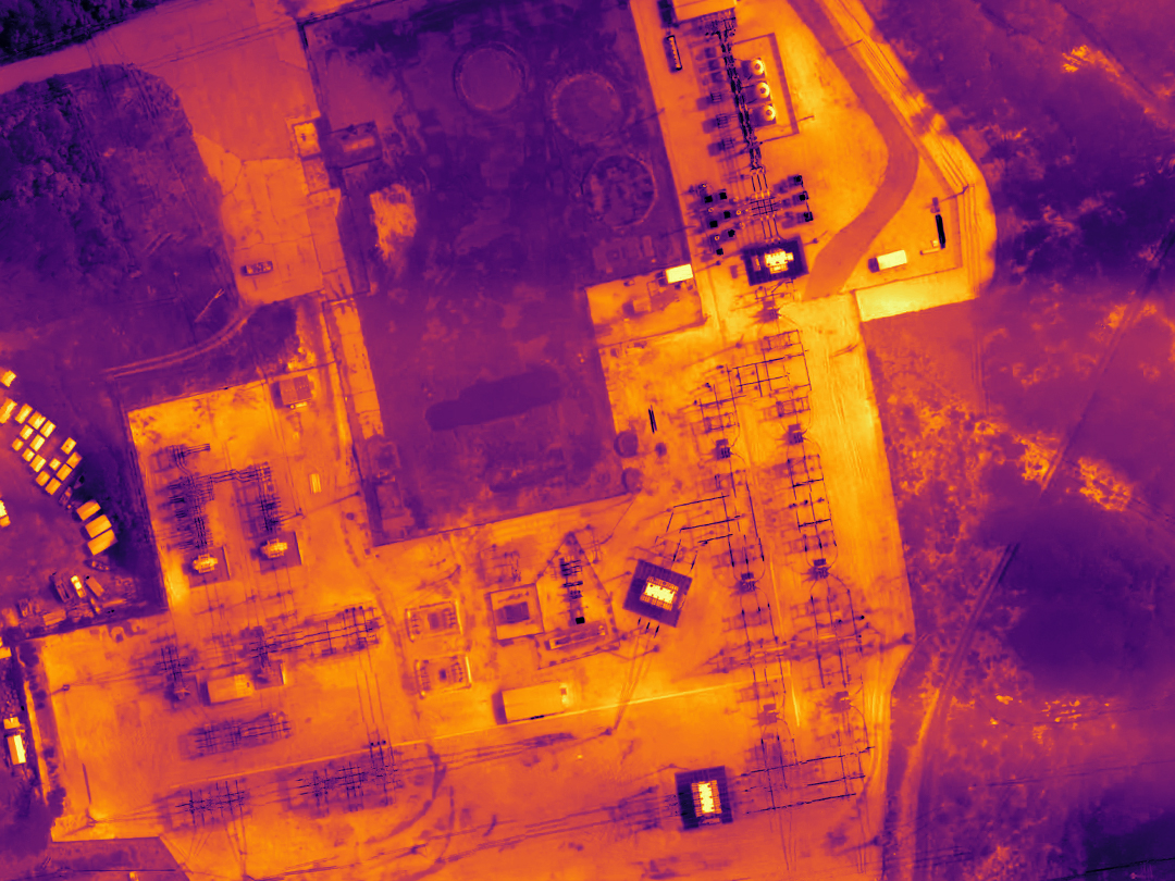
Thermal Inspections
Using State of the Art FLIR Thermal Imagery find leaks in your roof and optimize your insulation to save money on heating and cooling cost
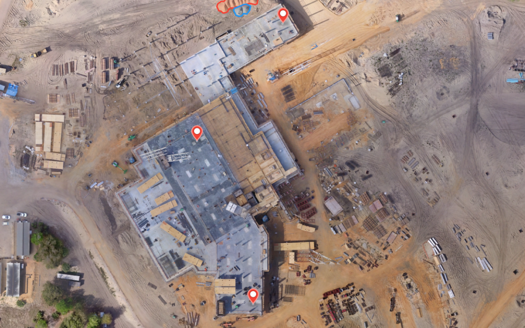
Building Inspection and Maintenance
Quickly map and model buildings to digitize the inspection and maintenance process, reducing costs while keeping personnel safe.

HVAC & Equipment Inspections
Inspect HVAC and other mission critical roof mounted equipment to ensure optimal performance without putting employees in harms way and without downtime
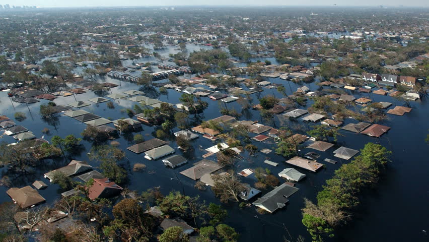
Natural Disaster Claims
Map and photograph large areas to acquire detailed, precise data using drones. Capturing accurate aerial data of your property after a natural disaster

Commercial Underwriting
Know with confidence that existing damage or issues will not be your problem.

Insurance Inspections
Capture previously unavailable insights with unbeatable speed.
Aerial Video & Photography
Stunning aerial footage including images, video, and panoramas to showcase your residential property from a unique perspective in the sky
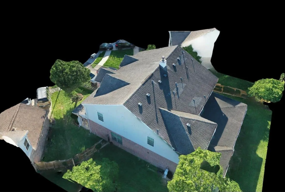
3D Models
Build high-definition 2D maps and 3D models of facilities and vertical structures using survey-grade drones, illustrating inspection results digitally

Virtual Tours
Build high-definition 3D models of facilities, properties and assets to allow clients to view the assets in 3D as if they were on site